Spatial Manager™ for AutoCAD - FAQs: Street View ("Professional" edition only)
![]()
![]()
Notes:
- Some components in the images on this page (providers, names, windows look, etc.) may be slightly different from those that will appear on your computer
- Some application functions need to access the Internet from the application itself. If you experiment problems in any process, ask your network administrator if there is a Proxy server installed on your network. You can configure the Proxy settings through the application options
Introduction
- Objective of this section
- To learn how to work with Street View dynamic images in the drawing
- Topics in this section
- Select street points and open the 'Street View' palette
- Street View navigation
Can I display Street View dynamic images in my drawing?
The Spatial Manager™ for AutoCAD 'SPMSTREETVIEW' command allows you to use the 'Street View' palette in order to view and navigate Street View images by selecting a drawing point for which such images exist
Note: This command was introduced in the version 7 of the application, so is not available for some old Autodesk products'

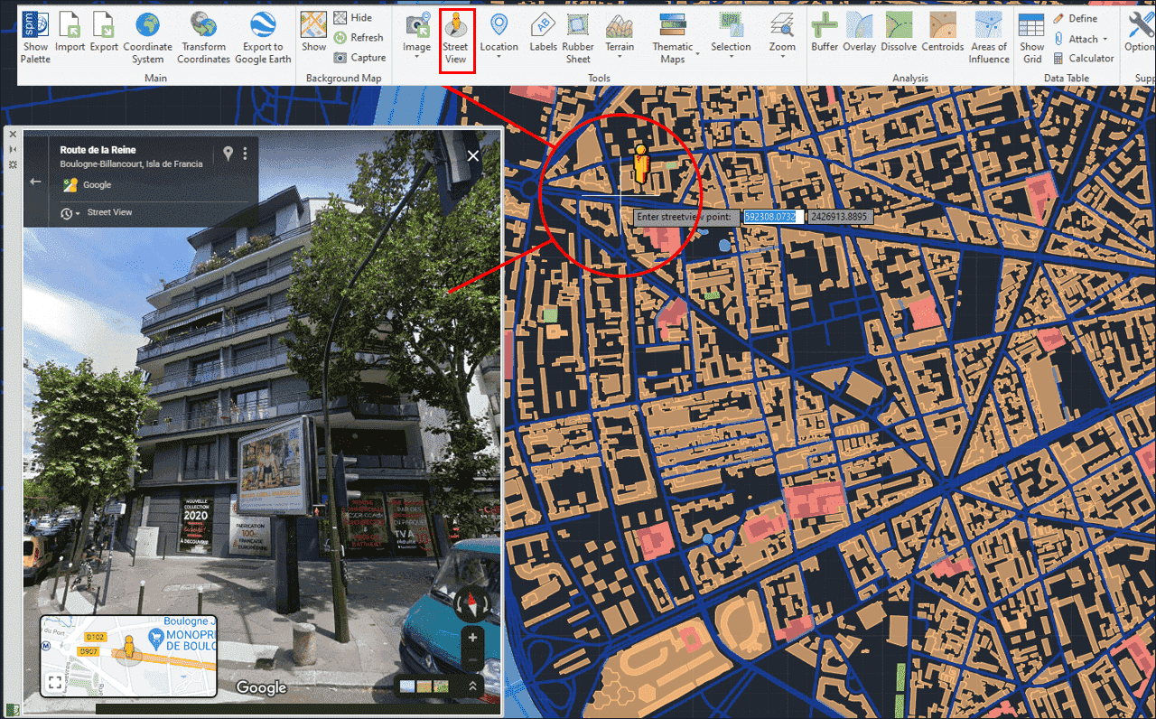
Street View - Select street point and palette
When you execute the 'SPMSTREETVIEW' command, a map of streets and roads for which Street View images are available is displayed on the screen and superimposed on the drawing (blue color). This map is automatically regenerated when the drawing view changes (Pan, Zoom, etc.). As in the Goggle Street View application, when you approach the cursor to a location near one of these streets or roads, the image of the icon next to the cursor changes and, by selecting the point in the drawing, it opens (if not already open) the Spatial Manager™ for AutoCAD 'Street View' palette, showing the available street or road image
Need to have some reference in the drawing to use 'Street View'?
If the drawing is not empty when 'SPMSTREETVIEW' is executed, it is necessary that the drawing has been assigned a Coordinate Reference System (CRS) in order that the application "knows how-to" how to locate in Street View. If this is not the case, you can assign a CRS to the drawing (and modify it) using the command 'SPMSETCRS' of Spatial Manager™ for AutoCAD. By executing this command, you will access the CRS catalog of the application where you can:
- Filter the CRSs by type (Geocentric, Projected, etc.). The type "Projected" will be selected by default because is the most common choice
- Choose a CRS by clicking on its row in the table
- Search CRSs by typing the search criteria in the "Search" box. You can type here as many words as you like separated by blanks. The application will find all the rows including all these words in any column of the table
- Unassign (undefine) the Coordinate System of the drawing, by choosing "Undefined CRS" (EPSG 0)
If the drawing is empty and has no coordinate system assigned to it, when 'SPMSTREETVIEW' is executed Spatial Manager™ for AutoCAD will assign the CRS Code:3857 (WGS84 / Pseudo-Mercator) to the drawing. This CRS is valid for any Earth area, but may be inaccurate for measurements in some areas. If you want to configure any other known local CRS, use the 'SPMSETCRS' command as explained above
- Notes:


CRS catalog of the application
Related links
![]()
![]()