Difference between revisions of "Spatial Manager™ for AutoCAD - FAQs: Thematic Maps ("Professional" edition only)"
Jump to navigation
Jump to search
m |
m |
||
| Line 32: | Line 32: | ||
| − | [[image: | + | [[image:SPMThemMaps.png|900px|Thematic Maps in a drawing|link={{filepath:SPMThemMaps.png}}]] |
| − | '' | + | ''Thematic Maps in a drawing'' |
Revision as of 20:03, 14 August 2022
![]()
![]()
Notes:
- Some components in the images on this page (providers, names, windows look, etc.) may be slightly different from those that will appear on your computer
- Some application functions need to access the Internet from the application itself. If you experiment problems in any process, ask your network administrator if there is a Proxy server installed on your network. You can configure the Proxy settings through the application options
- Some geographic data providers (Geocode, image Maps, etc.) may need a user account, which you can configure in the Service Provider API Keys settings through the application options
Introduction
- Objective of this section
- To learn how to change the visual appearance of objects depending on the values of a data field of an associated table (Thematic Map)
- Topics in this section
- Definition of new Thematic Maps
- Choose the type of a new Thematic Map
- Auto-generation of Themes or Rules
- Rules creation, deletion and editing
- Thematic colors of objects and optional fills
- Management of Thematic Maps from the application Explorer
- Activation and deactivation of Thematic Maps
xxx
Spatial Manager™ for AutoCAD includes the xxx
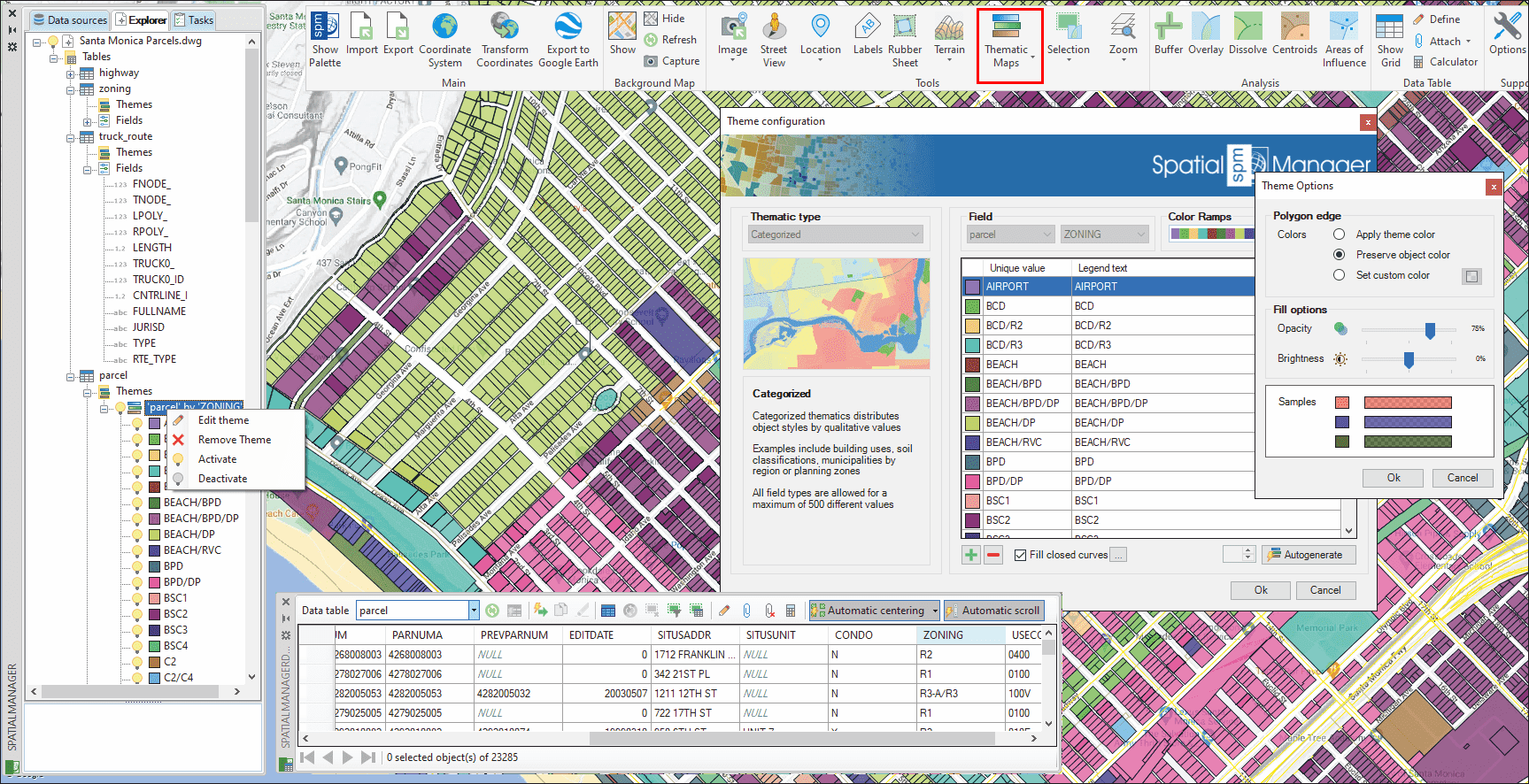
Thematic Maps in a drawing
Related links
- Blog posts
![]()
![]()